Church nearby Khomasdal Community Church
Namibia
Church nearby Khomasdal Community Church
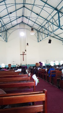
Khomasdal Community Church
Windhoek, Namibia
contacts phone
:
+264
Latitude:
-22.5439738
, Longitude:
17.0585864
larger map & directions
read more
nearest Church
223 m
Old Apostolic Church
Edsel Street, Windhoek
Church
read more
593 m
Khomasdal SDA Church
Aandblom, Windhoek
Church
read more
635 m
Church
Forbes Street, Windhoek
Church
read more
910 m
Church
Andrew Kloppers, Windhoek
Church
read more
970 m
Kingdom Hall Khomasdal
Verbena Street, Windhoek
Church
read more
987 m
FLWM-AGAPA KINGDOM, AHSWA and AGAPA.TV
Windhoek
Church
read more
1.003 km
AGAPA KINGDOM, FLWM
Windhoek
Church
read more
1.056 km
Old Apostolic Church Kloppersdal
Anemone, Windhoek
Church
read more
1.155 km
Church
Dawid Goeieman, Windhoek
Church
read more
1.428 km
christ love ministries international
30 34 p.o.box 8149, bachbrecht, windhoek, namibia, John Simms Street, Windhoek
Church
read more
1.493 km
Church
Windhoek
Church
read more
1.566 km
Christ Love Ministries
23, August Gotz Street, Windhoek
Church
read more
1.57 km
ELCIN Hosianna Parish
Windhoek
Church
read more
1.603 km
Jubilee Ministries
Visarend Street, Windhoek
Church
read more
1.618 km
NETS
Dorado Park
Church
read more
1.664 km
Old Apostolic Church
Windhoek
Church
read more
1.68 km
Church
Khomasdal
Church
read more
1.787 km
Hosiana Lutheran Church
Windhoek
Church
read more
1.799 km
EMO
Gamet, Windhoek
Church
read more
1.914 km
Church
Schonlein Street, Windhoek
Church
read more
1.975 km
Restoration Ministries International
Windhoek
Church
read more
2.118 km
Church
De Viliers, Windhoek
Church
read more
2.12 km
LDS Church
Windhoek Street, Windhoek
Church
read more
2.154 km
OASIS OF MANNA CHURCH NAMIBIA (OMCNAMIBIA)
Hans-Dietrich Genscher Street, Windhoek
Church
read more
2.406 km
Council of Curches
Windhoek
Church
read more
📑
all categories
Accounting
Administrative area level 1
Airport
Art gallery
Atm
Bakery
Bank
Bar
Beauty salon
Bicycle store
Book store
Bowling alley
Bus station
Cafe
Campground
Car dealer
Car rental
Car repair
Car wash
Casino
Cemetery
Church
City hall
Clothing store
Convenience store
Courthouse
Dentist
Department store
Doctor
Electrician
Electronics store
Embassy
Establishment
Finance
Fire station
Florist
Food
Funeral home
Furniture store
Gas station
General contractor
Grocery or supermarket
Gym
Hair care
Hardware store
Health
Home goods store
Hospital
Insurance agency
Jewelry store
Laundry
Lawyer
Library
Liquor store
Local government office
Locality
Lodging
Meal delivery
Meal takeaway
Mosque
Movie theater
Moving company
Museum
Natural feature
Neighborhood
Night club
Park
Parking
Pet store
Pharmacy
Physiotherapist
Place of worship
Plumber
Point of interest
Police
Political
Post office
Premise
Real estate agency
Restaurant
Route
School
Shoe store
Shopping mall
Spa
Stadium
Storage
Store
Supermarket
Taxi stand
Train station
Travel agency
University
Veterinary care
Zoo
sublocality level 1
↑